Free camping on BLM lands
This post is a guide to help you find places to park your RV, go boondocking and camp for free.
What is Dispersed camping
Called dispersed camping, most BLM lands (Bureau of Land Management) and most National Forest lands are open to camping for up to 2 weeks without any fees, this is across the southwestern US and elsewhere. There are no amenities available when dispersed camping, it’s true boondocking, and can be as remote as you want. You are really only limited by the size and off-road capabilities of your RV or camper setup. The BLM manages public lands in 12 western states. Be sure to check fire restrictions before you go. In some areas you may even need a gas stove permit.
Make sure you pack all trash and waste out with you. Practice zero-impact camping. Take only pictures (and a gold nugget or two) and leave only tire tracks. Leave your camp spot in better condition than you found it.
See my post: Where to boondock and camp for free on Forest Service lands
Western states with BLM land and dispersed camping
- Alaska
- Arizona
- California
- Colorado
- Idaho
- Montana
- Nevada
- New Mexico
- Oregon
- Utah
- Washington
- Wyoming
These are some of the main BLM regulations for dispersed camping
- 14 day camping limit in one spot in a 28 consecutive day period (14 days at one time or over several separate trips to the same campsite).
- After the 14 day period is up, you must move outside of a 25 mile radius from your old camp to your new camp.
- After the 28 day period is up, you may move back to your first camp for another 14 days. And so on. Check regional requirements by state here for possible additional regulations in certain areas.
- Some dispersed campsites are marked, usually those close to popular areas, and areas accessible by RVs and motorhomes. Many of the more remote sites are not marked. The BLM does prefer you to camp in spots that have been used before by others, if possible.
Free online resources to find BLM camping areas.
If you prefer a more developed campsite experience you might try recreation.gov. The website has an interactive map with campsite listings adjacent to outdoor recreation spots. You can pick a specific campground, view photos, reserve a spot, check fees and amenities, and check maximum vehicle length. Overnight fees vary widely.
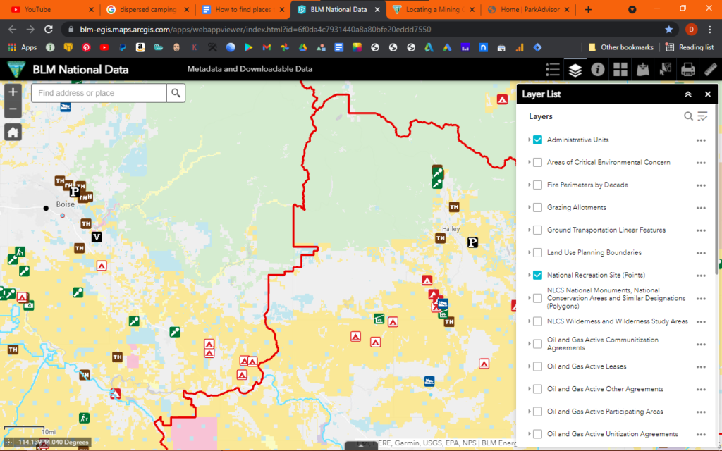
BLM National Data Viewer
The BLM has an online viewer to help you locate lands open to no fee camping. Open the viewer and check the National Recreation Site box. Zoom in to your area of interest, you will find a variety of symbols to click on, including both primitive and developed campsites.
There is usually only a limited amount of info available online for any given campground. Most if not all primitive campsites are no fee, and also no reservation (first come first served). Quite a few of the developed campsites are also no fee, no reservation.
Gather a list of campgrounds in the areas that interest you and call the BLM field office that oversees those areas. They will be able to give you more specific information such as any restrictions or additional regulations, closures, etc. Most of these campsites also have a 14 day limit in a one month period
Areas to boondock
The BLM National Data Viewer can also be used to find BLM lands open to dispersed camping, or boondocking. Open the viewer and check the two boxes that begin with NLCS. That will also bring into the viewer lands closed to motor vehicle access. BLM land is in yellow, and shown by default. A large portion of the west is BLM land, in fact Nevada is 63 percent federal land. Not all open to boondocking, but the majority is.
The viewer can be very helpful in locating open land. Especially if you are looking for general areas. To me that’s the fun of boondocking: not knowing exactly where you’re going to camp, until you get there.
Boondocking basics
Here are a few boondocking tips that i have learned over the years
Don’t try to find a good spot late in the day. If you have driven a long way to get to your area and it’s getting late, find a spot close to the turn off for the night. This obviously becomes more important if you are towing an RV or driving a lower clearance vehicle. Google Earth or Google Maps can help you find open spots to place markers or waypoints, which you can then upload to your GPS. I prefer Google Earth to do my planning, for one the close in resolution is much better than Google Maps.
If you are towing a trailer, consider un-hitching it so you can scout ahead in your truck. That way you can comfortably judge road conditions, find turn-arounds, and pick out a good campsite or two. Dirt road conditions can change drastically even over the course of a season or two. Don’t rely too much on information in guidebooks or on the internet. A call to the BLM field office that oversees your area may be able to give you current conditions. They can definitely fill you in on any restrictions or closures that may affect you. Here is a link to the BLM field office page.
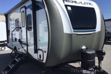
Personally I tow a 24 foot RV. A lot of BLM primitive and developed campgrounds have a maximum allowable trailer length of 30 feet, some shorter. Find out for sure before you go.If in doubt call ahead. If your RV is over 30 feet , you may run into trouble, (no pun intended) depending on where you plan to take it. My 24 foot RV is single axle with fairly good clearance. I’ve taken it over some pretty gnarly terrain with a minimum of problems.
When I boondock with my RV, I prefer to search out a good spot for a base camp, and then branch out from there to explore with my truck or quad. One thing I look for in a dispersed campsite is wind protection, usually lower, more sheltered spots. This also helps with privacy, as I personally don’t like camping on high ground where my RV may be visible for miles around.
That being said, I also NEVER camp in washes or drainage areas. See my post on flash floods
Here are some other posts that may be of interest.
How to use Google Earth as a prospecting research tool
(Useful for dispersed camping as well as prospecting. This post is a guide to importing geo referenced maps and metadata into Google Earth, and will help you find out EXACTLY where you are, or want to be, in relation to land ownership and/or land status.)
