Dos Cabezas & Teviston Mining Districts
Located in Cochise County in southeastern Arizona, about 15 miles east of Wilcox. There have been some large nuggets recovered here over the years. This would be a good place to do some drywashing and gold nugget detecting.
Land status:
The Dos Cabezas Mountains are a mixture of open BLM land, private land, state land, and patented lode gold mines. The easterly portion of the range has been withdrawn from mineral location and is now within the Dos Cabezas Mountains Wilderness Area. However, most of the historic mining district placer areas are open to prospecting and claim location. There are active placer and lode claims in the area, so be sure to stay off posted claims.
For more on how to check the land status see my post: How to find gold – Mining Research
Location:
Dos Cabezas Mountains, North slope (Teviston District) and South slope (Dos Cabezas District) lie between San Simon Valley and Sulphur Spring Valley in Townships 13-15 South, Ranges 26 and 27 East.
How to get there:
The Dos Cabezas district, on the south slope of the Dos Cabezas Mountains, is 15 miles east of Willcox on State Highway 186. The Teviston district, on the north slope of the Dos Cabezas Mountains, is accessed by a dirt road leading approximately 5 miles south of Interstate 10, 17 miles northeast of Willcox, and 6-1/2 miles west of Bowie (formerly Teviston). ,
Placer areas:
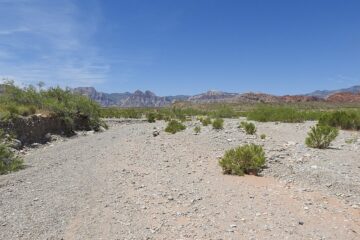
Placer gold deposits in the Dos Cabezas mining district are found in the dry washes and arroyos that drain the mineralized areas of the range, within an area about 3 miles long between Walnut Canyon and Howard Canyon. The most historically active placer gold deposits were located in portions of Sections 27-34, T. 14 S., R. 27 E. (Dos Cabezas USGS quadrangle).
Other gold deposits in this district are widely separated along the south slope near small gold prospects. The gold-bearing gravel pay layers in the washes of the main area are thin near the mountains and thicker toward the south near the old townsite of Dos Cabezas (sec. 32, T. 14 S., R. 27 E.). The gold here is mostly thin, rough, and fairly good-sized, with one old report stating that nuggets from I to 20 ounces were found.
The gold placers on the north slope of the Dos Cabezas Mountains (Teviston district) are found in the washes and on pediments at the base of the range. The area between Gold Gulch (sec. 24, T. 13 S., R. 26 E., Luzena quadrangle) and Ash Gulch (sec. 22 and 27, T. 13 S., R. 26E.) was where most of the historic placer mining occurred. Placer gravel on the pediment drained by Gold Gulch consists of coarse to fine sands with some clay and many boulders. Gravels sampled down to 6 feet reportedly assayed just over $4 a cubic yard (over $200 in 2021).
History of gold production:
The Dos Cabezas placers were reportedly discovered in 1901, although hard rock deposits in the district were known in the 1860s and worked off and on since the 1870s. Some reports state that the placers were known before 1901, although no production records from that time appear to exist. Most of the placer gold was recovered by drywashing the gravels, and, by panning and sluicing when water was available.
The gold placers of the Teviston district have been worked sporadically since the early 1900s, but earlier history is again unavailable. The Gold Gulch placers were worked by small dryland dredges in 1933, as were the Inspiration placers during 1937-38. The Ash Gulch placers were actively mined in 1930-31.
Production records combine gold recovery from the Teviston and Dos Cabezas districts, although the placers in the Teviston district were richer than those in the Dos Cabezas district.
Source of placer gold:
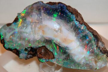
The gold in the placers was derived from erosion of gold-bearing quartz veins exposed throughout the Dos Cabezas Mountains. Most of the important lode-gold mines occur within, and near, a major fault zone 2-1/2 miles north of the old townsite of Dos Cabezas where small, closely spaced gold-quartz-sulfide veins occur; other gold mines are north of this fault zone.
USGS Topographic maps:
Dos Cabezas and Luzena 15-minute quandrangles. See: How to Read Topographic Maps for online sources of free USGS topographic maps.
Geologic map:
Cooper, 1960, Reconnaissance map of the Wilcox, Fisher Hills, Cochise, and Dos Cabezas quadrangle, scale I:62,500.
Free Land Status Maps: BLM National Data Viewer.
Free Mining Claim Maps: BLM Mineral & Land Records System (MLRS).
Source:
Placer Gold Deposits of Arizona
Additional research materials:
Allen, 1922: Discovery; location; (Dos Cabezas district).
Bray, 1933: Describes dryland dredge used at Gold Gulch.
Church, 1887: Notes nonactivity in placer mining, although lode mining was active.
Engineering and Mining Journal, 1931: Assay results of sampling at Gold Gulch placer.
Erickson, 1968: Dates mineralized quartz veins.
Gardner and Johnson, 1934: Placer-mining techniques in Gold Gulch; drywashing; type of gravel.
Heikes and Yale, 1913: Value of gravels; the size of a large nugget (Teviston district).
Land, 1931: History; the size of nuggets; emphasis on lode deposits (Dos Cabezas district).
U.S. Bureau of Mines, 1931: Location of placer-mining operations.
U.S. Bureau of Mines,1939-41: Placer-mining operations at Inspiration placers; dragline dredge; the amount of gravel handled; no location for placers.
Wilson, 1961: Location; history; depth of gravels; size of gravels (Teviston district); production.
Wilson, Cunningham, and Butler, 1934: Bedrock geology; history and description of lode mines; does not describe placers.